Use of Drones in the Surveying Industry
With almost 90 years’ experience in the surveying industry, we are well known for our work on a range of residential, industrial, and commercial development projects. We asked our Surveyor and Chief UAV Pilot, Quentin Doig, to talk us through how drone technology is changing the surveying industry.
26 Aug 2021 | 4 min read
How is drone technology integrated into your operations?
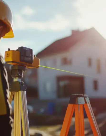
We are using drones more and more in our daily activities and operations. Initially, they were primarily used for unique situations and jobs where it would have been unsafe or impractical to use conventional surveying methods, for example collecting data on the slips caused by the Kaikoura earthquakes. Now we are finding them increasingly useful for other roles such as marketing, inspection, and monitoring. As clients see what they are capable of, there are more opportunities to incorporate them into different aspects of the job.
As the Chief UAV pilot at Eliot Sinclair, what does your job involve? What does your typical day look like?
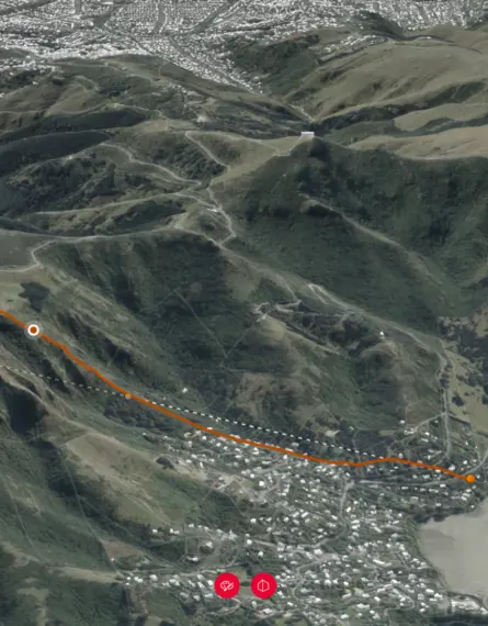
Every day is different. We can be doing an aerial survey of the Kaikoura coastline one day and then flying in Arthur’s Pass the next. There’s lots of variety with UAV aerial surveying as well as unique challenges to overcome, especially with regards to meeting airspace requirements and obtaining proper permissions from landowners and local authorities.

There are three main stages to a typical job that I could be working on during any given day. Stage one is when we plan the flight and search what survey control is available in the area. This also includes identifying any affected parties and mapping out the airspace that we’ll need to operate in.
Next, the fieldwork is undertaken. This involves establishing survey control onsite and using the drone to capture the required data. The final stage is to process the raw data into a set of useable outputs for our client. Each job is unique, with varying techniques and outputs.
Aside from the practical work for clients, my role also includes plenty of internal work as well. I keep track of the flight time for the UAVs in our fleet and maintaining them accordingly as well as updating software and firmware when required. I’m also involved in a variety of other tasks such as training new pilots and keeping track of their current flying hours/experience. We are Part 102 certified so there are legal requirements that must be met, including yearly flight reviews and competency tests.
You use a range of drone technology in your role, what do you use and how has this technology helped your operations?
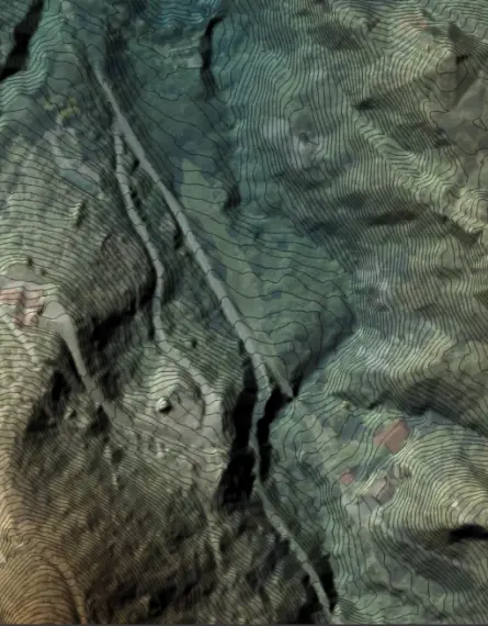
We currently have 5 drones and various software packages to handle the data collected. We work with Ferntech Commercial who supply all our hardware and software. Currently we’re using the DJI Phantom 4 RTK, the DJI Matrice 600 and the DJI Zenmuse P1 among others. We have a high spec PC and use Pix4d as our processing software, followed up with 3DReshaper and Global Mapper.

The improved camera technology on modern drones, such as the Zenmuse P1, enables us to fly higher while capturing the same level of detail. This is far more efficient so we can complete jobs faster than before. We have only recently started using the Zenmuse P1, so we are looking forward to seeing how it can improve our results and efficiency on future jobs.
How do you think drone and camera technology is changing the surveying industry?
It’s becoming far more practical and cost effective to fly sites than to survey them using traditional methods. The cost, reliability, and ease of drones combined with huge advances in photogrammetry software are drastically changing the surveying industry in this field. The data being produced is of such a quality that this is the preferred option for many large and challenging sites. The UAV is becoming a standard tool in many surveyors’ toolboxes throughout the country.
What are your predictions for the future of aerial surveying?
I think drones will continue to prove their usefulness in surveying and engineering applications. New and fast changing technology will continue to increase their efficiency and capability. Developments in LIDAR (Light Detection and Ranging) will result in lighter, cheaper units which will be ideally suited to UAV use. There is an exciting future ahead in this area.